
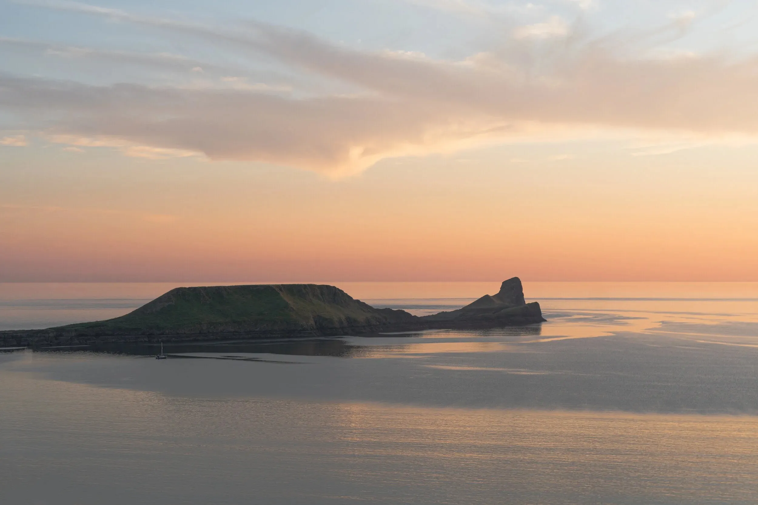
Walking Worm's Head
Everything you need to plan your walk: parking at Rhossili, the rugged limestone scrambles, Devil's Bridge, blowholes, and essential countryside & wildlife codes.
Protecting Grazing Livestock & Wildlife
Sheep graze freely across the headland year-round, frequently accompanied by young lambs. Dogs must be kept on a short lead to prevent livestock worrying, injury, or animals being chased over cliff edges.
The free-roaming Gower ponies and horses maintain the wild coastal turf. Feeding them human food (including carrots, apples, or bread) causes fatal colic and encourages dangerous crowding around walkers.
The National Trust strictly prohibits drone flying across Rhossili cliffs and Worm's Head. Drones distress nesting seabirds on cliff faces and spook grazing animals near sheer drops.
Terrain Reality Check: What Underfoot Conditions Are Really Like
This is a rugged coastal scramble, not a surfaced footpath.
Half a mile of loose, uneven boulders, slippery green seaweed, barnacle-encrusted rocks, and deep gullies. Sturdy boots with ankle support are essential—flip-flops or flat sneakers lead to frequent twisted ankles.
The section between Inner Head and Devil's Bridge (Low Neck) is particularly grueling. You must navigate sharp, tilted limestone beds, loose scree, and knife-edge rock ridges where hands are frequently required for balance.
The full return trek to Outer Head and back to the mainland takes 3 to 3.5 hours of continuous hard walking and scrambling. You must set off as soon as the causeway opens to return safely before the tide cuts off the reef.
Step-by-Step Route Stages
Four distinct sections make up the traverse of the Worm.
Descend from the lookout. Cross 800m of jagged tidal causeway. Exposed for ±2.5 hours around low water.
Ascend the grassy mound of Inner Head for panoramic vistas of Rhossili Bay, the Gower coast, and Devon.
Scramble down sharp limestone beds to cross the natural arch of Devil's Bridge connecting to Middle Head.
The far tip with seal colonies and the blowhole. Look for harbour porpoises in the fierce tidal races.
Getting to Rhossili & Parking
Plan your travel and parking before heading down the narrow Gower roads.
National Trust Car Park
Located at the end of the B4247 in Rhossili (SatNav postcode: SA3 1PR). Pay & display parking is in operation; free for National Trust members.
⚠️ Can fill up quickly on sunny weekends and bank holidays. Arrive early.
Public Transport (118 Bus)
The regular 118 bus service runs from Swansea Quadrant Bus Station directly to Rhossili village bus stop, just a short walk from the cliff path.
Check Swansea bus timetables in advance for Sunday and evening return times.
Walk to the Lookout
From the car park, follow the surfaced cliff-top track past the National Trust shop towards the old Coastguard lookout station (roughly 0.7 miles / 15-minute gentle walk).
Station what3words: ///reclaimed.exporters.options
Rhossili Village Facilities
All public amenities are located in Rhossili village by the main car park, before you walk out along the cliff path:
- 🚻 Public Toilets: Located next to the National Trust visitor car park.
- ☕ Food & Refreshments: Local cafés, ice cream shops, and The Worm's Head Hotel.
- 🛍️ Visitor Centre: National Trust shop and information center.
Lookout Station & Leave No Trace
Our NCI lookout station is an active operational coastal watch station situated in an isolated cliff-edge position:
❌ No public toilets, running water, or mains electricity exist at the lookout station.
🗑️ Zero Waste / No Rubbish Bins: The station has no rubbish collection service. We cannot accept visitor waste, food packaging, or dog bags.
Landmarks & Lore of the Worm
From ancient limestone caves to poets stranded by the tide.
The Atlantic Blowhole
A deep fissure into submerged caverns near Outer Head. On days with a heavy swell, compressed air and sea spray erupt with a thunderous roar.
Devil's Bridge Arch
The roof remnant of a collapsed prehistoric limestone cave, forming a dramatic natural bridge with crashing sea below.
Dylan Thomas Stranded
In the 1930s, the poet fell asleep on the Worm, was trapped by the tide, and had to spend a cold night on the rock until dawn reopened the reef.
Wildlife of Worm's Head
Worm's Head is a National Nature Reserve managed by Natural Resources Wales.
Atlantic Grey Seals
A resident colony hauls out on the sheltered rocky reefs below Outer Head. In autumn, white-coated pups rest on secluded ledges.
Never approach or disturb resting seals.
Guillemots & Choughs
The sheer cliffs provide nesting ledges for fulmars, razorbills, kittiwakes, and the acrobatic red-billed chough.
Outer Head closed 1 Mar – 31 Aug for nesting.
Porpoises & Dolphins
Strong tidal rips off the tip churn up nutrient-rich waters, creating prime feeding areas for harbour porpoises and dolphins.
Our lookout scopes monitor sightings daily.
Confirm Your Timings at the Lookout
Before descending to the causeway, stop by the NCI Lookout Station on the cliff top. Check the day's tide board, ask our watchkeepers any questions about conditions, and make note of your absolute return time!